Evanston: props; clarification; iPadding

Several of you have written to suggest that I ask the boat yard to use standing props to support GANNET so I can reach the areas under the trailer pads.
I had thought of that and did not do so for a number of not very good reasons. On Saturday, I did ask and received an equivocal response from the service department.
I probably won’t be back up to the boat until late this week.
If Skipper Bud’s has propped the boat, I’ll sand off the remaining VC17. If not, I’ll go ahead and apply the Vivid and remove the VC17 when the boat is again out of the water at the end of the summer.
----------
A clarification:
The top photo in the previous post shows GANNET as she looks now.
The second photo was taken when she was hauled from the water last October and shows what her bottom looked like before I started removing the red VC 17.
Her new bottom will be white.
In addition to my liking the contrast of white bottoms and dark topsides, when I had a new rudder made for THE HAWKE OF TUONELA about a dozen years ago, the builder’s warranty was invalid if one used dark anti-fouling paint because the company had done research showing that dark anti-fouling absorbed too much heat, at least in Florida where they were located, which could result in expansion and damage to the thin-skinned rudder.
I am also going to paint out the red rub rail and replace the Minnesota registration numbers with those of Illinois.
I had hoped to do this after I painted the topsides, but it isn’t going to happen that way.
----------
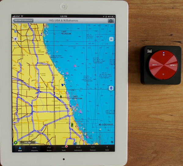
The photo above shows the iPad and the external Dual XGPS150a.
The Dual is very light and a little over 2”/5.5 cm square. It almost instantly makes the Bluetooth connection to the iPad and obtains a fix quickly, which it held even when moved several feet away from the window for the photo, so perhaps it will do so inside GANNET without needing directly to see the sky.
When I first used the Dual I wondered if the position on my iPad was being provided by it or by the iPad’s internal GPS and emailed iNavX for some guidance.
Although I received a very quick response, I found the answer myself in an online support group.
In the iPad settings, turn on Airplane Mode, which turns off the iPad’s GPS and Bluetooth. Then in settings, turn Bluetooth back on. Any position is now coming from the external source, which I proved to my satisfaction by turning the Dual on and off and seeing the position obediently appear and disappear from the chart.
According to iNavX, the iPhone 4/4s and iPads with 3G or 4G will obtain positions even in mid-ocean from their internal GPS. The iPhone 3 will not. So an external antenna may not be necessary. Still, I’d rather spend $99 and know I have the back-up, than find out at sea I need it.
The above chart is Navionics rather than NOAA. I bought the Navionics charts of the U.S. to compare them with the free NOAA charts.
Thus far I don’t know that I have a preference; but I will need to buy Navionics charts for other parts of the world.
Martin, in England, has found another chartplotting app, Polar View, which he prefers and which has the U.K charts available for less than Navionics.
I have viewed its tutorial. It seems similar to iNavx and costs the same.
The pricing of Navionics charts is odd.
The entire U.S., including Alaska and Hawaii, costs only $35. All of South America, including the Caribbean costs $50. However, the UK, Ireland and Holland costs $70. And little New Zealand alone costs $85.
----------
This is Living Earth HD, 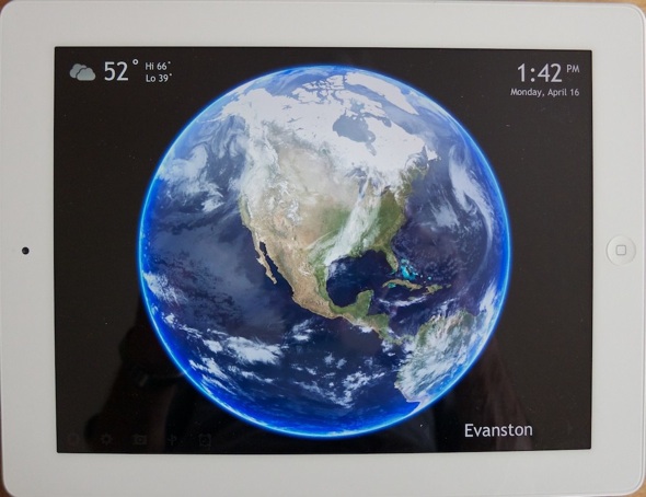 a free app that provides, among other things, live cloud display updated from satellite images every three hours.
The band that passed through here over the weekend, causing tornados farther south, can be clearly seen.
The image can be set in motion and shows day and night.
I particularly enjoy spinning down to check out Cape Horn and the Southern Ocean.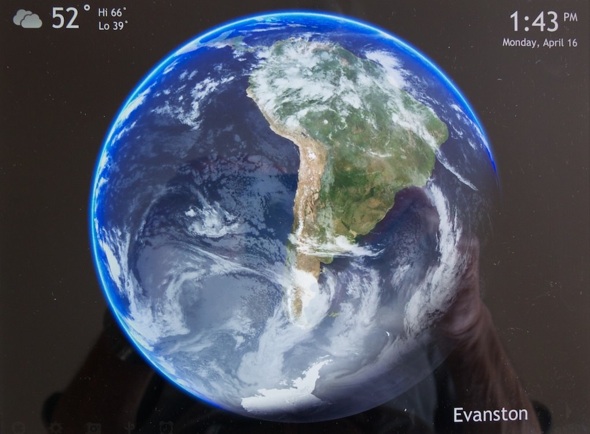
Monday, April 16, 2012